| Search |
|
 |
|
|
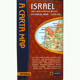
Map of Israel and Autonomous Areas |
|
|
|
Publisher: Carta Jerusalem
|
|
|
|
|
|
|
|
|
Product Description |
|
|
- Over 3,500 named locations, mountains, rivers and streams.
- Road classifications & numbers.
- Road No. 6 (Toll Road).
- "Israel Walking Trail" from Dan to Eilat.
- Interchanges and junctions highlighted.
- Topography & elevations - Altitudes - Border crossings - Ports and airports.
- Detailed index - Glossary of Hebrew terms
60x90 cm (24x35½ in.), folds to 13½x23½ cm (5¼x9¼ in.); scale 1:270,000 |
|
|
|
|
|
Related Categories/Items |
|
|
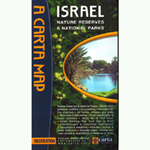 Map of Israel - Nature Reserves & National Parks Map of Israel - Nature Reserves & National Parks
|
|
|
|
|
|
Need Help? |
|
|
If you need assistance or information,
please contact us
Call 718-258-9696 or info@gotjudaica.com
Helpful Site Links: Shipping
Information Return
Policy |
|
|
|
|
|
 PRINT PAGE
 EMAIL PAGE
 |
|
|